|
|
|

ROCKY
TALK ON FaceBook
Rocky
Point TV
NEW
HIGHWAY CONNECTING TO YUMA NOW OPEN New
Highway From Puerto Peńasco to El Golfo Open Highway
SON 003
connecting Puerto Peńasco and El Golfo de
Santa Clara is now open for travel. The
new highway connects Rocky Point directly to San Luis Rio Colorado
(Yuma). The long
awaited shortcut to California is
finished. 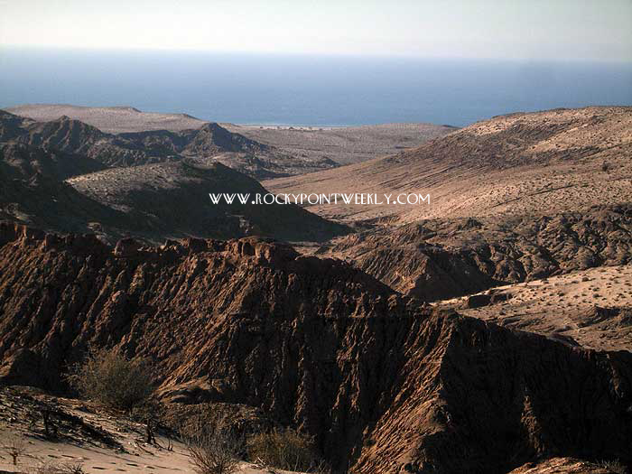
Click
photo to enlarge
We
departed from Puerto Peńasco
on January 3, 2009, at about 8:15
a.m. to travel the new road and to report our
findings to our readers. In 1957
my father, Bob
Stirling, undertook a similar
adventure for the Tucson Daily Citizen,
traveling with his family of eight in a VW bus from
Nogales to Mexico City. Thus, this trip
also served as a fitting tribute to my father,
who would have loved to have been along.
I drove, while my wife, Debbie, took the
photos on this page. Highway SON 003
is found by turning off the main highway back
to Arizona (Mex 008) at the turn off to Laguna
del Mar. The
highway
begins where the road to Laguna
del Mar turns north
to the Laguna Shores Country Club. It continues along the
coast of the Sea of Cortez to El Golfo de Santa Clara, 90
kilometers (56 miles) from Puerto Peńasco.
This 90
km section is the only new construction on the
230km
(143 miles) highway to San Luis Rio Colorado. Our total travel time was
three-and-a-half hours, but we often stopped
along the way. Highway SON 003
is only a two lane highway, but the asphalt
surface is well engineered and easily
handled the limited traffic encountered along
the way. The posted speed limit is 90 km
per hour (55 mph). A
biosphere reserve information center and
pullout is found just six miles north of Rocky
Point. Highway 003 runs through the
reserve (Reserva
de la Biosfera El Pinacate y El Gran Desierto
de Altar), which is well fenced from the
highway with four by four cement posts and
barbed wire. Posted signs prohibit
stopping and entering the reserve anywhere.
A second information pullout is located closer
to El Golfo. While
Highway SON 003 follows the coast, the Sea
of Cortez is only visible from the highway
for short distances along the way. Railroad
tracks are sporadically visible about 50 yards
to the east of the highway. About
nine miles north of Rocky Point is the El Sol
Bar and Restaurant. It was too close and
too soon to stop, so we kept moving. It
looked like somewhere we would have stopped in
1957. Signs soon indicate the presence
of wetlands, "zona de
humedales."
Posted signs along the highway clearly
prohibit any off-road vehicles and
trespassing. The area is part of the
protected Humedales
del Delta del Río Colorado, of Baja
California and Sonora. The
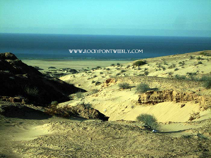
highway is marked along the way with kilometer
posts, and at KP51 there is an estuary and sand
dunes along the road. A warning sign
cautions drivers to be alert for sand piling
up on the asphalt. We encountered sand
on the shoulder of the road in two locations,
but not on the traveled portion of the
roadway. All drivers should remain alert
for shifting
sands, which can be encountered
around any corner or hill. Around
KP75 a lot of Cholla type cacti
(Jumping-Cactus) appear throughout the
area. The cement posts in this area are
laid out alongside the road in an orderly
fashion awaiting their placement and barbed
wire. Sand dunes appear on both sides of
the highway. About
an hour north of Rocky Point there were six
large earth moving tractors and trucks
assembled for what looked like work on a new
road to the east. It was just bladed
dirt and extended a very short distance. 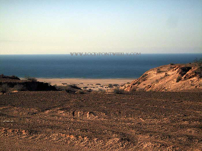
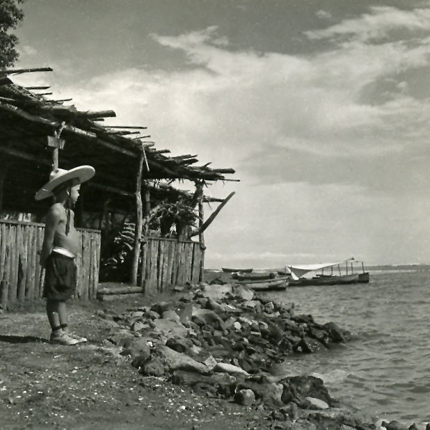
Click photo to enlarge
El
Golfo de Santa Clara was reached at about
10:15 a.m., but we stopped at many locations
along the way to take pictures, and we
traveled very slowly through some areas taking
notes. We also backtracked a few times to get
the best scenic shots visible from the
road. We used less than a quarter tank
of gas in our GMC Sierra pickup truck, which
has a 26 gallon tank.
|
 |


april
romo de vivar - artist
Highway
003 actually bypasses El Golfo (link to
map before completion - large PDF file). To enter
the town make a left turn southbound at a road
junction where the new SON 003 ends and
connects to the old highway north to San Luis Rio Colorado.
Travel one mile south to enter El Golfo de Santa
Clara. Unfortunately, this one mile of road looks
like a landfill with large amounts of
garbage littering both sides of the road all
the way into town. We
continued into the town of El Golfo and traveled along the
only
paved section of roadway beside a school, houses, and small businesses.
Dirt roads intersected the main paved section,
which was no more than several hundred yards
in length. The dirt roads led to the Sea
of Cortez. No Pemex station was visible
anywhere from the main road.
Reports from other travelers claim there is a
Pemex station somewhere in town. We elected to
return to the highway without exploring El
Golfo, which appeared to offer little at
first glance. If there is a Pemex
station in town, we did not see it. El
Golfo is popular with off-roaders. Be
warned: the Mexican government will prosecute
anyone who enters the natural preserve.
The Mexican military may arrest you if you are
caught in the dunes, estuaries, and
wetlands. No ATVs allowed. On
the road to San Luis about 22.7 miles north of
El Golfo, the paved road ended at KP77.
We were detoured
on dirt for
about a mile. Traffic was stopped at a Mexican
Army check point at KP76, where a friendly
soldier asked to search our
truck. We graciously agreed and exited
the truck while he glanced at and poked at our
suitcases. The search lasted no more
than a minute or two and we were on our
way. The pavement
resumed 23.3 miles north of El Golfo just
after the checkpoint. No
where along the highway did we see any of
Mexico's famous "Green
Angels" vehicles, and no where did we
see any Pemex stations. A state police
vehicle drove through the Mexican Army
checkpoint while we were there. No other
law enforcement vehicles were seen anywhere on
the trip, except at an accident scene. If
you ever have an emergency anywhere in the
State of Sonora, just dial the new hotline
"help" number 078. See GREEN
ANGELS link above. The
distance from El Golfo de Santa Clara to San Luis Rio Colorado
on Highway SON 003 is 111km (69 miles).
This section of the road is not
new and the surface reflects its age.
At times the painted lane divider
disappears. The road at many places is
elevated three feet higher than surrounding
terrain with no shoulder. If you are
inattentive at any time, you could easily
rollover. This
road is not like the section
from Puerto Peńasco to El Golfo.
Pot-holes are found along the way, and
at one section of the road (27.9 miles north
of El Golfo until 28.4 miles north) the holes
are so large that on-coming trucks and
cars leave their assigned lane and drive at you
head-on. So remain alert at all
times. One hole occupied the entire
southbound lane. Never assume the old highway meets modern engineering
design or construction standards (large
PDF file). Citrus
groves interlaced with agave
plants are found about 30 miles north of El
Golfo. A tire repair shop sign (a
painted wheel in the sand) indicated
a repair shop was located five miles
ahead. A small village is located about
38.2 miles north of El Golfo, where the repair
shop was located. The mountains from the
Baja side of the Sea of Cortez are visible to
the west. There is also a church, a school, and
a fish store. The village ends
39.1 miles north of El Golfo. A
transmission tower is located 40.4 miles
north, and there is a small store selling
wheat and honey on the east side of the
highway. Trees started to appear and
the desert began to give way to irrigated
agriculture. Approximately
41.7 miles north of El Golfo, in the town of
Estacíon Riito, the highway
jogged right over railroad tracks,
where we witnessed the aftermath of a truck
collision with a car.
Police were on scene, and a few miles later we
saw an ambulance
headed south towards the accident site. San Luis Rio Colorado
is 39
kilometers (24 miles) away. Here we saw
the only Pemex station outside San Luis, but it was abandoned.
|
|
|
|
|
|
We arrived in San Luis
at 11:45 a.m. with our gas tank still 2/3 full. Once in
the city we noticed no signs directing us to the border, so we
continued straight ahead. We soon knew that somewhere along the way we should have
turned. The
pavement ended. We
stopped at a Pemex station in San Luis to ask for directions.
Very friendly men directed us two miles up the street where the road ran into the
border fence. They told us to turn left at the
fence. We turned
left and proceeded along the three lane street until traffic
backed up. We were stuck in a long line of cars waiting to
enter the U.S. We stayed far to the right along the
fence, and it appeared both lanes moved at about the same
speed. We were in line for one hour and 30 minutes
(Saturday) before reaching the U.S. Customs agent. He asked for our
passports. Today
proof of citizenship is required to enter the U.S., although
passports are not technically required until June 1, 2009, according
to the agent who admitted us into the country. Travelers
should obtain one now. Once
inside the U.S. it took another 30 minutes to travel through
San Luis, Gadsden, and Summerton to reach Yuma. San
Diego is 172 miles west on Interstate 8, about a
two-and-a-half hour drive, depending on the Border Patrol
check point in the mountains outside San Diego. Quick
tips before you go:
-
Gas up and check
oil, water, tires, belts, hoses and spare tire
-
Carry plenty of
extra drinking water and tools
-
Take a cell phone
and/or CB radio
-
Charge cell phone
battery before leaving
-
Do Not Drive At
Night
-
Dial 078
to call
for EMERGENCY HELP
-
143 miles from Puerto Peńasco
to San Luis Rio Colorado.
-
56 miles from Puerto Peńasco
to El Golfo de Santa Clara
-
Drive safely,
respect the signs and avoid high speed
-
Don’t drive if
you are tired
-
Don’t drink and
drive
-
Use your seatbelt
-
Do not litter
-
DO
NOT DRIVE OFF-ROAD IN PROTECTED ZONE!
|
Advertise
Your Business Here |
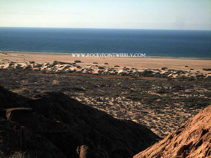
Click
photo to enlarge View
from alongside Highway 003 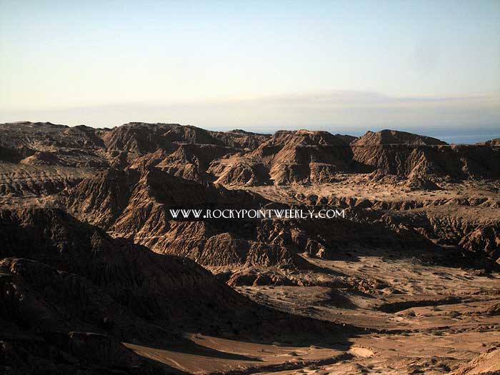
Click photo to enlarge
|